Summary of the Research Proposal
“High-above-the-mountains” aims at an extensive aerial archaeological survey over mountainous uplands of Crete (Greece) for the creation of a gazetteer of historical human settlements or simple built structures and related cultural constructions.
The project originates from the consideration that the space which surrounds us and with which we continuously interact, is not a static entity. It is the result of the complex relations and influences of humans (and their cultures), animals and landscapes [1,2]. Material and tangible results of such interactions (which often involve many more variables than the above outlined) are normally reshaped, repurposed, obliterated, damaged or endangered in view of the “development” of certain areas. However, sometimes, past standing structures become iconic elements of the landscape of which they are part, in a certain spontaneous monumentalisation process, as almost fossil or fossilized built landscapes. Their embodiment the surrounding landscape is such that their presence is often underestimated, misinterpreted or simply ignored.
The tendency to neglect past built environments, even when their construction on hardly accessible mountainous spots enhances their value as cultural heritage, is provoked (and paradoxically it provokes as well) and is favoured by the ignorance of their aetiology: what is this structure; has it always been like this; who built it; why was it built and why here; is anybody still using it; how often and for what reason/s?
Following on Knapp and Ashmore assertion [3], landscape is “an entity by virtue of its being perceived, experienced, and contextualized by people”. If the interdependent relationships that people maintain with the physical, social, and cultural dimensions of their environments across space and over time [4] are broken, the landscape itself loses its cultural identity and, more important, a page of history and culture of mountain people is lost. The ambition of the proposed research is to bridge the gap of the modern knowledge about abandoned mountainous villages, moving between traditional geomorphic views of landscape to more phenomenological or cultural perspective with solid ethnographical bases.
The relationship between people and land is always active and dynamic [5]. It involves something “done with” the environment, not something “done to” it. This is a sort of taphonomic perspectives, applied to the study of landscapes, where the evolution of landscape “participates in necessarily interlinked cultural and natural processes” [6]. At the same time, landscape structure must be identified and quantified in meaningful ways before the interactions between landscape patterns and ecological processes can be understood. Most landscapes have been influenced by human land use, and the resulting landscape mosaic is a mixture of natural and human-managed patches that vary in size, shape, and arrangement [7].
This research project was funded by the Research Centre for the Humanities (RCH), with the support of the John S. Latsis Public Benefit Foundation.

To see the conference’s program in Greek, click here and browse to the tab “Ημερίδα”.
To read the abstracts of the conference’s English presentations, click here.
Research Project: “”HIGH-ABOVE-THE-MOUNTAINS. Fossil Built Landscapes on Mountainous Uplands from the Sky””
Webpage: http://cretefromabove.ims.forth.gr/en
Research Team: Gianluca Cantoro, Stefania Michalopoulou, Christina Tsigonaki
|
The research project “HIGH-ABOVE-THE-MOUNTAINS. Fossil Built Landscapes on Mountainous Uplands from the Sky” was funded by the Research Centre for the Humanities (RCH) for the year 2017, with the support of the John S. Latsis Public Benefit Foundation. |
|
|
|
Abstract
The paper presents the innovative and unprecedented (at least in Crete and Greece) approach for the documentation of the mountainous activities on the island of Crete (Greece), mainly focused to the early-byzantine and post-modern period. The project, titled “HIGH ABOVE THE MOUNTAINS – Fossil Built Landscapes on Cretan Mountainous Uplands from the Sky” and funded by the Research Center for the Humanities, aims at understanding the material culture of apparently hostile rocky mountainous landscape starting from its view-from-above, i.e. the aerial view.
Historical archive and recently acquired aerial photographs and satellite images are the starting point for a research focusing on the abandoned villages and standing structures, which populate the high mountains of the largest Greek island. Once areas of interest were identified and a provisional chronology proposed, targeted ground reconnaissance was undertaken to improve, enrich or amend the gained knowledge from the aerial survey.
Important aspect of the project was the involvement of local communities in terms of input (assistance for the interpretation of standing artefacts) and output (validation or confrontation of proposed interpretation). Indeed, deliverables of the project were not ending-point of dissemination, but rather beginning steps of a deeper involvement and engagement of local communities and scientific society in this collective effort for proper documentation of surviving traditions and consolidated practices.
Results of the project were series of “fossilized” moments and cultures in need to be re-discovered and re-valorized with larger and more systematic practices that should involve locals as main actors, rather than spectators.
Introduction
The space which surrounds us and with which we continuously interact, is not a static entity but the result of complex relations and influences of humans (and their cultures), animals and landscapes. Material and tangible results of such interactions are reshaped, repurposed, rehabilitated, damaged and/or endangered in view of the “development” of certain areas. In less developed zones, such material heritage stands as iconic elements of the landscape, result of a spontaneous monumentalisation process.
For these iconic artefacts (broadly speaking), the embodiment in the surrounding landscape is such that their presence is often underestimated, misinterpreted or simply ignored. These built landscapes could easily be described as “fossilized”, and often that is the case on the Cretan Mountains. On the (apparently) hostile mountainous environment, the built structures become rare and sparse and the repurposing of pre-existences becomes a sort of necessity for people living the mountains.
The tendency to neglect past built environments is provoked (and paradoxically it provokes as well) and is favored by the ignorance of their aetiology: what is this structure; has it always been like this; who built it; why was it built and why here; is anybody still using it; how often and for what reason/s? This is particularly true even when the construction of such artefacts on hardly accessible mountainous spots ideally enhances their value as cultural heritage, because of the difficulties in finding the required material, bringing it up-top and working in such challenging altitudes.
Having in mind the above, a research project has been built under the name “High Above the Mountains: fossil built landscapes on Cretan mountainous uplands from the sky”. The project, funded under the 2017 open call of the Research Center for the Humanities, has 4 main objectives:
- to create the principles and collect data for the future fixing of an atlas (in the shape of geographical database) of abandoned and collapsing built structures and villages on the mountainous volumes of Crete
- to contextualize and understand the reasons of the landscape changes
- to involve and engage local communities and young researchers to the importance of the Mountainous cultures
- To interact with the local society (repository of traditions and practices) and bi-directionally enrich each other understandings of the past.
Why Crete?
The assumption by which landscape is a sort of evolving organism where humans and animals interact, modify the surroundings and are influenced by them, makes the mountains the ideal playground for historical-ethnographical-archaeological works. Here all factors are enhanced and multiplied given the (apparently) hostile conditions. The possibility to have such a “laboratory” on an island, that is, on a limited space with controlled communications with “external” environment, is ideal. Therefore, the selection of working on the largest of the Greek islands and among the largest in the Mediterranean Sea was natural.
Crete has been described as a “mountain emerging out of the sea” (R. Matton, 1957), with more than half of its territory being mountainous (peaks more or less between 1500 and 2500 m. a.s.l.). Mountains and mountain ranges (Psiloritis/Idi, White Mountains and Dikty, to mention the most important ones), occupy approximately 52% of the island and constitute the main geographical feature of the Cretan landscape. Plain-lands occupy a mere 3.6%, letting the remaining percentage to hills, valleys, small plains, plateaus and gorges.
Despite the apparent inhospitality of this place, Crete is still one of the most populated islands in the Mediterranean and definitely one of the most attractive touristic destinations. Most of the island landscape’ units, even the mountainous ones, have been influenced by human land-use, and the resulting mosaic is a mixture of natural and human-managed patches that vary in size, shape, and arrangement. Those elements are clearly part of the Cretan symbols and they are so in such a way that their presence is often underestimated, misinterpreted or simply ignored. If we stop wondering or questioning ourselves on the above, we break the relationships that people maintain with the physical, social, and cultural dimensions of their environments and consequently the landscape itself loses its cultural identity.
Indeed, landscape is defined as “an entity by virtue of its being perceived, experienced, and contextualized by people” (Ashmore and Knapp 1999). And this perception makes it (or part of it) to exist and survive to time. The ambition of the research project is therefore to bridge the gap of knowledge about mountainous life of Crete with a combination of historical, archaeological and ethnographical perspectives and sources.
The project and its outputs
Following the Lozny (Lozny, 2013) “multivocality of landscape” (as opposed to the “landscape polarity”), High-Above-The-Mountains project moves between traditional geomorphic views of landscape to more phenomenological or cultural perspective with solid ethnographical bases. The relationship between people and land is always active and dynamic. It involves something “done with” the environment, not something “done to” it. This is a sort of taphonomic perspectives, applied to the study of landscapes, where the evolution of landscape “participates in necessarily interlinked cultural and natural processes” (Athanassopoulos, Wandsnider 2004).
Given the above aim of research, in combination with the specialties and the capabilities of the project’s team members and the large extent of territory under investigation, the view-from-above was considered as the most suitable research tool to drive the field activities (Masson, Palmer, Campana 2013; Cantoro 2015).
Beside the original point-of-view, aerial photographs (and historical aerial photographs in particular) are definitely unique documents of a continuously changing environment and they are often able to freeze the moment either before the field mechanization (especially recognizable in photographs from the First and Second World War) or during and after the modifications. Heavy large-scale changes and landscape reshaping are more often appearing in the rare hilly/flat areas but some tourist driven expansions (for hotels or infrastructures for excursions and hiking) or economic development projects (as wind farms and the road networks that serve these farms) are also putting at risk some normally inaccessible areas. In such conditions, the mapping of cultural heritage with ground survey may be time consuming, sometimes unsuccessful or unfortunately too slow compared to the modern landscape development.
Historical aerial photographs from the Hellenic Military Geographical Service, oblique photographs taken by G. Cantoro in past aerial archaeological campaigns, drone photos and satellite images accessible through the web constitute the background dataset on which the project was built. Archives of aerial photographs (whether from the First or Second World War or from modern aerial survey campaigns) are a rich source for identifying otherwise unknown monuments and can provide unique records of landscapes and sites that have been changed or destroyed by intensive agricultural practices, touristic expansion or other development projects. Indeed, the places in which we live-in are always changing: parts of towns and cities may be rebuilt and the countryside changes as farming practices develop. Dated aerial photographs may therefore show processes that happened gradually and almost unnoticed –such as the abandonment of a village–, or capture moments of time or depict agricultural practices difficult to date.
The “complexity” of the Cretan landscape and the limited presence of flat areas seem to contrast the wealth of standing or buried artefacts visible from the air in hardly accessible spots. For such a rich context, rescue archaeological excavation, although important, are not sufficient and often do not provide the wider picture that most human-landscape interactions need in order to be properly understood. The approach from the air is undeniably beneficial in similar situations, where professional cameras can be pointed at specific contexts during airborne systematic or targeted survey flights.
This bird-eye view survey, at times integrated or driven by historical imagery analysis, allows to visualize traces of the past –at times not recognizable from the ground– that then need to be stored and publicly presented. Aerial pictures have also undoubted appeal in raising public awareness on surrounding space. But the research does not end with an aerial photograph; on the contrary, it may just start from it. Indeed, when an area of interest has been identified with this image-based analysis, a targeted fieldwork takes place to verify and enrich (or correct) the gained knowledge.
Additionally, the role of ground surveys on selected areas and interviews with locals were of complementary but essential nature since it favored the “tagging” of abandoned and collapsing artifact with archaeological and/or historical facts, promoting at once the involvement of local communities. In line with this “win-win” approach, where we as researchers learn or enrich our understanding of material culture and we share it with a wider community through an web-portal, a workshop and academic presentations, a photographic exhibition was built in the framework of the project. Indeed, if on the one side this exhibition had the goal to disseminate preliminary results of the research, it also aimed at gaining new knowledge from visitors’ feedback. The exhibition was therefore intended for wider public and though in two language (English and Greek) to facilitate the access to locals and tourist in the month of August 2017. Here visitors were exposed (often for their first time) to aerial and ground photos of Cretan mountainous landscapes enriched with explanatory texts, videos, music and interactive installations. Interaction with the public was assured by guided visits organized by the project’s team where listening was as much important as presenting.
Conclusion
The paper presented the first results of “HIGH ABOVE THE MOUNTAINS – Fossil Built Landscapes on Cretan Mountainous Uplands from the Sky” project. Aim of the project was to understand the material culture of apparently hostile mountainous landscapes with the original (and unprecedented in Greece) view-from-above.
Multiple sources have been employed for the verification of information acquired and interpreted from remote sensing approach: ground survey, historical document exam, digital documentation of standing structures, publications and previous field research. These more traditional methods were sided with constant connection with local communities, involved in the process of information acquisition and dissemination. Example of such activities is the organized open lectures and workshop or the public photographic exhibition in a very popular summer destination in high season period.
Results of the project are series of “fossilized” moments and cultures in need to be re-discovered and re-valorized with larger and more systematic practices that should involve locals as main actors rather than spectators. It is the case of a rich heritage of local traditions and common practices for the managing of animals and landscapes, where the contribution of the community allows a smooth and seamless adaptation to local geographic conditions in a profitable but respectful way.
Acknowledgments: Special thanks goes to the Research Center for the Humanities (RCH) for funding this project in 2017; to the GeoSat ReSeArch Lab at the Institute for Mediterranean Studies (IMS-FORTH), which hosted some of the events and offered precious support for field activities.
Thanks also to Giannis and Manolis Gadanakis, Nektarios Sfakianakis, Marianna Katifori, Anna Paraskevopoulou, Foteini Spitadaki, mr. Michalis Ygeiomenakis, Angeliki Alygizaki, Nikos Betinis, G. Moschovi, Daphni Chronaki, Iphigenia Methymaki, Tina Chanialaki and Nadia Coutsinas. Their precious help importantly contributed to the success of the project.
Cited papers
Ashmore, W., and Knapp, A. B. (eds.), 1999. Archaeologies of landscape. Contemporary perspectives. Oxford: Blackwell Publishers; p. 1.
Athanassopoulos E. F., Wandsnider L. (eds.), 2004. Mediterranean archaeological landscapes: current issues, 1st ed, University of Pennsylvania Museum of Archaeology and Anthropology, Philadelphia; p. 10.
Cantoro, Gianluca 2015. “Aerial Reconnaissance in Archaeology – from Archives to Digital Photogrammetry. In Best Practices of GeoInformatic Technologies for the Mapping of Archaeolandscapes, Archaeopress, Oxford; p. 103-114.
Lozny, Ludomir R. 2013. Landscape Archaeology of the Commons of the Bouleste/Labas Valley, Hautes-Pyrénées, in Continuity and Change in Cultural Adaptation to Mountain Environments, Springer Science & Business Media; p. 138
Matton, R. 1957. La Crète au cours des siècles, Athens.
To view the academic report with figures, click here.
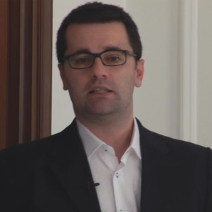 Gianluca Cantoro is a landscape archaeologist and photo-interpreter. His background is in Roman provinces archaeology (BA and MA at the University of Pisa, Italy) and aerial archaeology of mountainous landscapes (PhD on Crete at the University of Foggia, Italy). He is an active member in international communities of remote sensing experts and he often organizes workshops and summer-school in Europe, serving as aerial or ground tutor.
He had the opportunity to organize the first aerial archaeological survey in Crete (first flights in 2009 for INSTAP and then 2011 for IMS-FORTH) and the main idea for this project started then.
His actual fields of interest involve the user of modern digital technologies and tools (digital laser scanning and aerial/ground photogrammetry) for the documentation and study of cultural heritage.
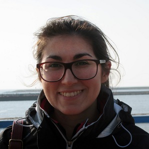
Stefania Michalopoulou is an archaeologist with specialization in Zooarchaeology and Prehistory. She studied at the University of Athens – Greece (BA, MA, PhD).
She has worked for the Greek Ministry of Culture and the National Hellenic Research Foundation in the past.
She was trained in archaeological excavation as student and later as member of research teams in various sites with chronology spanning from Paleolithic to Byzantine period.
Part of her work on zooarchaeological materials (big mammal fauna and herpetofauna mainly of Neolithic but also Archaic, Roman and Early Byzantine period’s) is in the process of being published.
Her research interests span from zooarchaeology and prehistory (her main fields of work) to ethnoarchaeology and landscape archaeology, with a principal focus on animal-landscape interactions.
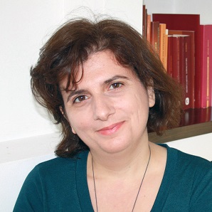
Christina Tsigonaki is assistant professor in Byzantine Archaeology at the Department of History & Archaeology of the University of Crete and member of the Institute of Mediterranean Studies (Foundation for Research and Technology-Hellas).
She received a D.E.A. in Byzantine Archaeology from the University Paris I, Panthéon-Sorbonne. She received her Ph.D. from the same University with a scholarship by the Greek State Scholarship Foundation (IKY). She is a member of the interdisciplinary research group for Ancient Itanos, East Crete. Since 2009 she has been conducting the excavation of Sector II at Ancient Eleutherna, Central Crete. Her research interests are focused on the archaeology of the East Mediterranean at the early Byzantine period, with emphasis on architecture and topography.